Back to top
Back to top


“Working with RUSH we now have a viable path forward, using Unreal Engine as a platform to deliver a functioning prototype that we can start to give our customers. This has given us a fantastic platform to build on, with an open-ended future where one of the biggest 'problems' is where to start with the many options now available to us.”
MetService, Te Ratonga Tirorangi, is New Zealand's national weather authority delivering powerful weather intelligence nationally and internationally. Their meteorological intelligence and data visualisation products supply global organisations and weather channels including Al Jazeera, TVNZ, Nine Network Australia, and Sky UK to name just a few.
With rapid changes in technology, MetService saw an opportunity to bring the next evolution of a weather platform to life. A product that would take in MetService climate data and forecast expertise, and output photo-realistic visuals based on that data. This would enable people to understand forecasts in the same way they view the real world, as if they're watching live action.
A 3D computer graphics game engine such as Unreal Engine was specified as the tool for the job, and MetService worked with RUSH to draw on our capability for really deep exploration.
The Human Centred Design challenge was to enable non-technical individuals to create a highly bespoke show that responds to the changing environment around them in minutes opposed to what was taking a team anywhere from hours to days.
Services provided
Feasibility Validation
Experience Auditing
Research
UX Design
UI Design
Frontend Development
Backend Development
Minimum Viable Product
Training & Capability Development
12 years
Since the platform has been evolved
500M
Daily global viewers of the platform's output

The MetService team are global experts in their field and have first-hand experience of the scenarios producers go through to create weather visualisation, and what happens within the news environments.
This expertise joined forces with RUSH’s human-centred design exploration through Kano surveys, user interviews and user testing to understand the JTBD of the four main stakeholders; the Presenters, the Meteorologists, Graphic Designers and Graphics Producers. This included talking to weather presenters across the globe including from TVNZ and Three in New Zealand, Nine Network in Australia, RTL in the Netherlands, and Al Jazeera.
Meeting weekly, the tight collaboration between MetService and RUSH enabled co-creation of the ideal visualisation for elements such as rain, wind, and snow, the three different levels of clouds and what weather should look like from different angles with different forces.
Working together on this platform enabled MetService to reach v1 with significant speed, and their internal team will continue to build on its success and grow the project.
"RUSH checked our beliefs and validated them, or challenged them with confidence and tact, based on real user research and critical thinking. A lesser development partner would have simply started writing code and given us exactly what we asked for, rather than what our users actually need. We also valued the care and attention that was taken with understanding our users and I know they enjoyed the interactions with RUSH too."
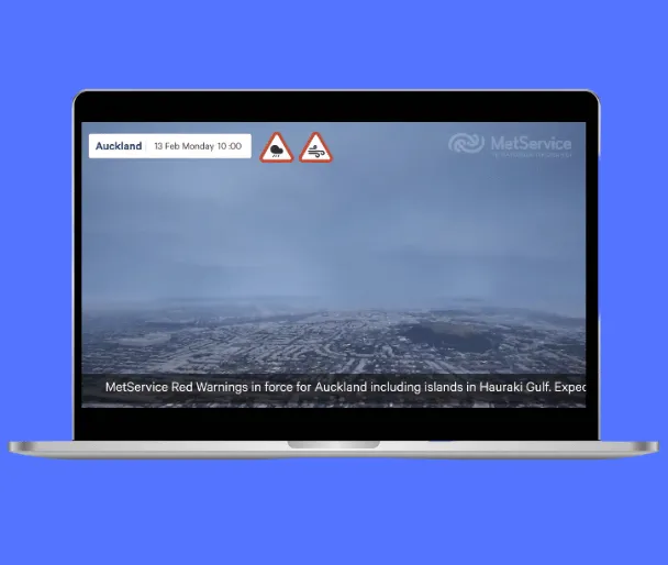
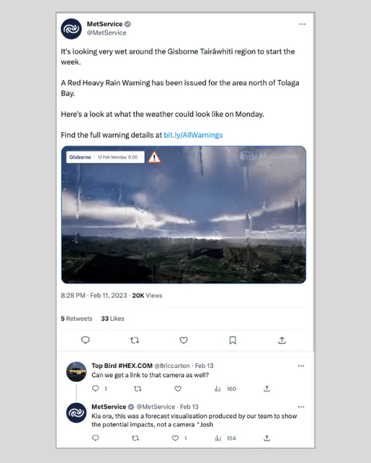
Combining Unreal Engine with a new weather API provides an accurate visual weather forecast for now and the next 48 hours, anywhere in the world. By using Bing maps and a global terrain plugin, we were able to create a geographically accurate globe with 3D cities and terrain. Three layers of 3D volumetric clouds bring to life Meteorologist-Certified layers to represent weather patterns. The platform can also simulate far, near and close hail, snow and rain – complete with drops streaking down the ‘camera’ lens.
Leaning heavily on progressive disclosure, the design team created a UX/UI which shows only the most relevant or necessary information to the user at any given time, hiding more complex or less important information until it is needed. This delivered a huge amount of comfort in the user testing with stakeholders, especially compared to traditional video editing software which is quite overwhelming.
To try out a clickable prototype of the Environmental Visualisation platform, please visit this page on desktop.